What the National Hurricane Center Does and Why It Matters
The NHC tracks tropical weather and forecasts possible development; its latest Gulf outlook signals a chance of formation, not a settled local forecast.
The short version
- The National Hurricane Center, or NHC, is a NOAA and National Weather Service division that tracks and predicts tropical weather systems in parts of the Atlantic and Pacific 2.
- On October 5, the NHC gave a disturbance in the southwestern Gulf a 60% chance of developing within two days and an 80% chance within seven days 1.
- Those percentages describe the chance of development, not the chance that a particular town will be hit or flooded 1.
- The disturbance's future track, strength, rainfall and local impacts remained uncertain in the available report 1.
What is the National Hurricane Center?
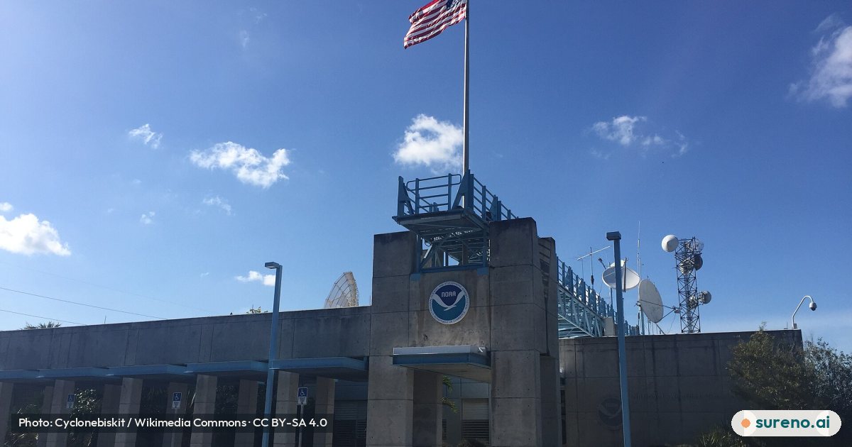
The National Hurricane Center, usually shortened to NHC, is part of the National Oceanic and Atmospheric Administration and the National Weather Service. It tracks and predicts tropical weather systems in the northern Atlantic and northeastern Pacific within the areas described by its overview 2.
In plain terms, it monitors developing tropical weather and issues information that helps people understand what may happen next. The NHC is the organization being cited in current headlines about a disturbance in the southwestern Gulf.
Why is the NHC in the news now?
On Monday, October 5, a weather disturbance in the southwestern Gulf was producing disorganized showers and thunderstorms. The NHC gave it a 60% chance of developing into a tropical system within two days and an 80% chance within seven days, according to the local report 1.
Forecasters expected gradual development to be possible and said a tropical depression or storm was likely to form during the middle part of the week 1. That was a forecast at the time of the report, not confirmation that a storm had already formed.
What do the 60% and 80% chances mean?
They describe the reported chance that the disturbance would develop within the stated time windows. They do not say that a storm is certain, and they are not a forecast that any particular place has an 80% chance of being struck.
The report says the system's eventual track and strength were still uncertain. Forecast models differed over whether an approaching weather system might draw it toward the northern Gulf Coast or leave it farther south and east 1.
What could this mean for people near the Gulf?
The report said rain chances could increase across southeastern Louisiana late in the week and into the weekend, but it was too early to identify rainfall amounts, the strongest winds, or the places most likely to experience flooding 1. The information therefore pointed to a situation worth following, rather than a precise local impact forecast.
For an ordinary reader, the useful distinction is between a disturbance that may develop and a reliable forecast of effects at home. The available report does not provide enough detail to say which communities, if any, would face specific impacts.
What should readers watch for next?
The report described an expected eastward drift over the next couple of days, followed by a possible turn northward, while emphasizing that the track and strength remained uncertain 1. The path could affect where rain and wind develop, so later forecast information may clarify the outlook.
Check updated information from the NHC and your local weather service for current conditions and local guidance. The sources available here do not establish what happened after the October 5 report.
What we don't know yet
- Whether the disturbance developed into a tropical depression or storm.
- What track and strength it ultimately took.
- Which areas received the most rain or strongest winds.
- Whether flooding occurred and where.
Share this explainer
Get this every day, on every new tab
Sureno Browser brings the day's stories, explained simply, to your start page.
Questions people ask
What does NHC stand for?
NHC stands for National Hurricane Center. It is a NOAA and National Weather Service division that tracks and predicts tropical weather systems in parts of the northern Atlantic and northeastern Pacific 2.
Is there a tropical storm in the Gulf right now?
The October 5 report described a disturbance with showers and thunderstorms and said a tropical depression or storm was likely to form during the middle part of the week 1. It did not confirm that a storm had formed, and the information here does not show later updates.
Does an 80% chance mean the Gulf Coast will be hit?
No. The 80% figure in the report was the chance of development within seven days, not the chance of a specific place being hit 1. The disturbance's track and local effects were still uncertain.
Could the Gulf disturbance affect Louisiana?
The report said rain chances could increase across southeastern Louisiana late in the week into the weekend, but the track and impacts remained uncertain 1. It was too early to pinpoint rainfall amounts, strongest winds or likely flooding areas.
Where can I find the latest hurricane information?
The National Hurricane Center is the agency monitoring and forecasting the disturbance described in the report 1. Check its current updates and local weather-service information, because the October 5 forecast may change.
Sources
- Watching the Gulf: Development chances increase to 80% — WDSU, 2026-10-05
- National Hurricane Center — Wikipedia
More to read
 Home & LifeApuração das eleições 2026: como funciona e o que mudaOct 5, 2026 · 3 min read0 views
 Home & LifeAllegiant Stadium: What It Is and Why It’s in the NewsOct 5, 2026 · 3 min read0 views
 Home & LifeAngela Paxton’s Ad Backs GOP Ticket Without Naming KenOct 5, 2026 · 3 min read0 views
 Home & LifeWhat the CRA is and why a North Bay kitchen made newsOct 5, 2026 · 3 min read0 views
 SportsLions vs. Panthers: What to Know About the NFL GameOct 5, 2026 · 3 min read0 views
 Home & LifeWhat the polar vortex is and why UK winter talk is growingOct 5, 2026 · 5 min read0 views
 Home & LifeWhat Teachers Do and Why Schools Are Protesting in FranceOct 5, 2026 · 6 min read0 views
 Home & LifeOctober Weather Swings From Cold Snap Back Toward WarmthOct 5, 2026 · 5 min read0 views
 Home & LifeAuckland Mayor Calls $1.75b Mill Road Plan IdioticOct 5, 2026 · 4 min read0 views
 WorldIrán: qué es, por qué es noticia y qué cambia para tiOct 5, 2026 · 6 min read5 views