Rains Swamp the Gandak River - NASA Science
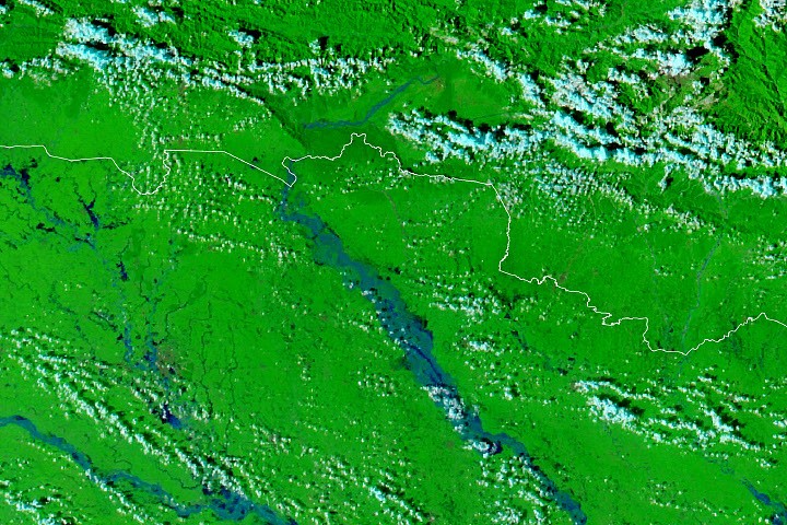
Heavy rain fell across Nepal’s Lumbini and Gandaki provinces from September 24 to 27. The storms triggered landslides and drove the Gandak River, also known as the Narayani, to record heights in Nepal and India.
Rising water spread through the river’s branching channels, overtopped or broke embankments, and flooded farms and communities over a wide area. News reports said hundreds of villages were affected and thousands of people displaced.
NASA satellite images taken on September 20 and 29 show the extent of the flooding. In the false-color images, floodwater appears blue, while vegetation is shown in bright green.
Some flooding covered seasonal farmland on low-lying river deposits, where inundation is expected. But water also reached settled areas, including parts of Bagaha, Areraj, and Fulia Khand.
Nepal’s hydrology department reported that a gauge at Devghāṭ reached 11.94 meters on September 27, its highest reading since records began there in the 1960s. News reports also identified new high-water marks at four Indian gauges. NASA offers online tools for monitoring rainfall and floods, including Worldview and the FLOOD Viewer.
Key points
- Late September rains caused landslides and record river levels in Nepal and India.
- Flooding damaged farmland and settlements; reports said thousands were displaced.
- A Devghāṭ gauge reached its highest level since records began there in the 1960s.