Hurricane Isaias becomes Category 3 storm as it threatens northern Gulf Coast. See maps, forecast path.
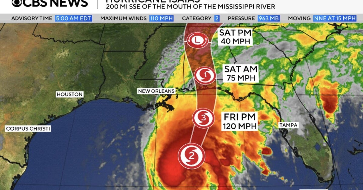
Hurricane Isaias, the first Atlantic storm of the 2026 season, reached Category 3 strength Friday. Forecasters expect it to hit the northern Gulf Coast that evening, threatening Mississippi, Alabama and Florida’s western Panhandle.
The hurricane center said the storm could be at or near major-hurricane strength at landfall. It is forecast to cross Alabama before moving into the Tennessee Valley over the weekend. By Friday, its center was about 125 miles southeast of Mobile and traveling north.
Tropical-storm conditions had reached the coast, and Dauphin Island recorded a 47 mph wind gust. Forecasters warned that storm surge combined with high tides could flood coastal areas, with water levels reaching 9 feet in some locations near the Alabama-Florida border and Florida’s Grayton Beach.
Hurricane-force winds may reach up to 100 miles inland into southern Alabama. The storm could also bring damaging gusts across parts of Georgia, the southern Appalachians and Middle Tennessee, along with heavy rainfall and a tornado threat through Saturday.
Evacuations are under way in parts of Florida’s Okaloosa and Walton counties. Alabama Gov. Kay Ivey has urged coastal tourists and visitors to leave; an order covers visitors in parts of Baldwin County and on Dauphin Island. The storm is expected to continue inland over the weekend.
Key points
- Isaias strengthened to Category 3 and was forecast to make landfall Friday evening.
- Storm surge, inland winds, heavy rain and possible tornadoes threaten areas across the Southeast.
- Evacuation orders affect parts of Florida’s Panhandle and Alabama’s coast.