LIVE MAP: Track the path of Tropical Storm Isaias
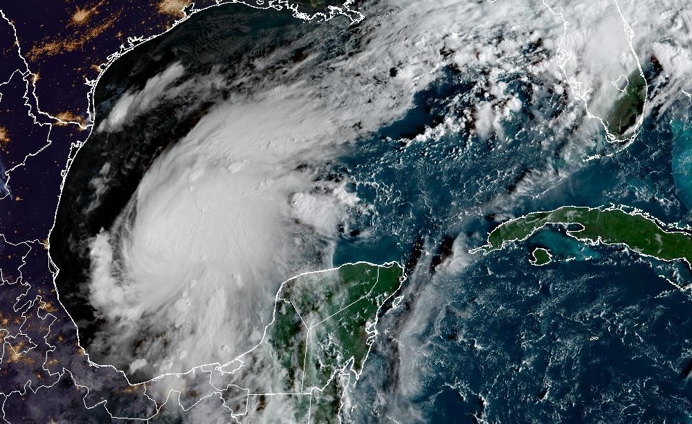
Tropical Storm Isaias developed Wednesday in warm waters off eastern Mexico. The National Hurricane Center reported sustained winds of 40 mph as the system moved east-northeast.
Forecasters expected Isaias to intensify into the Atlantic season’s first hurricane. Its eventual landfall location was uncertain, but early projections placed it between eastern Louisiana and the western Florida Panhandle late Friday or early Saturday.
The hurricane center warned of possible dangerous winds and storm surge along parts of the northern Gulf Coast. It urged residents from Louisiana to the Panhandle to follow forecasts and prepare.
Florida Gov. Ron DeSantis declared an emergency in 25 counties across the Panhandle and Big Bend. The measure activates the state’s disaster response plan, including the potential deployment of staff and equipment.
Forecasters also expected heavy rain across parts of the Gulf Coast and much of the Southeast from Friday into the weekend. Residents were advised to monitor updates as the storm’s track became clearer.
Key points
- Isaias formed Wednesday and had maximum sustained winds of 40 mph.
- Early forecasts put possible landfall between eastern Louisiana and the western Florida Panhandle.
- Florida declared an emergency in 25 counties as officials prepared for potential impacts.