

What to know as
How El Niño is defined
El Niño is a climate pattern marked by warmer-than-average water in a particular equatorial region of the Pacific Ocean. It occurs every two to seven years and typically lasts nine to 12 months.
NOAA declares an event after El Niño conditions appear in the tropical Pacific for five consecutive three-month periods. The threshold is sea surface temperatures at least 0.5 degrees Celsius above average; temperatures 2 degrees or more above average for five such periods would qualify as a “very strong” event.
Global weather shifts
El Niño’s effects differ by region, influencing hurricane frequency, sea levels, flooding, drought and seasonal snowfall. Those changes can also affect fishing, agriculture and utilities that depend on rainfall and wind for power.
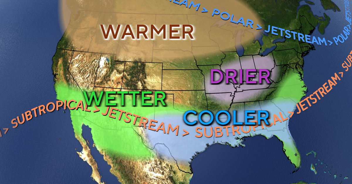
Southern North America tends to have wetter conditions as Pacific storms become more frequent, while the continent’s north is likely to have milder, drier winter weather. Eastern Asia and southern South America are also forecast to receive more precipitation, which may ease drought in some places but raise flooding risks.
Storm activity and strength
El Niño tends to hinder tropical storm development in the Atlantic while favoring it in the Pacific. The article says it played a key role in record-low Atlantic tropical storm and hurricane activity this year and contributed to record intensity in the Pacific season.
El Niño’s strength often shapes how sharply it affects global weather. This year’s event is among the strongest on record, and NOAA expects it will most likely continue through March.
Key points
- NOAA reported tropical Pacific temperature anomalies above 4 degrees Celsius as of Nov. 12.
- El Niño can bring wetter conditions to some regions and drier or milder weather to others.
- The pattern tends to suppress Atlantic storm development while supporting Pacific activity.
- NOAA expects this El Niño to likely persist through March.