Winter Forecast Shows Snow and Rain May Bring Relief to Drought-Stricken States
South May See More Precipitation
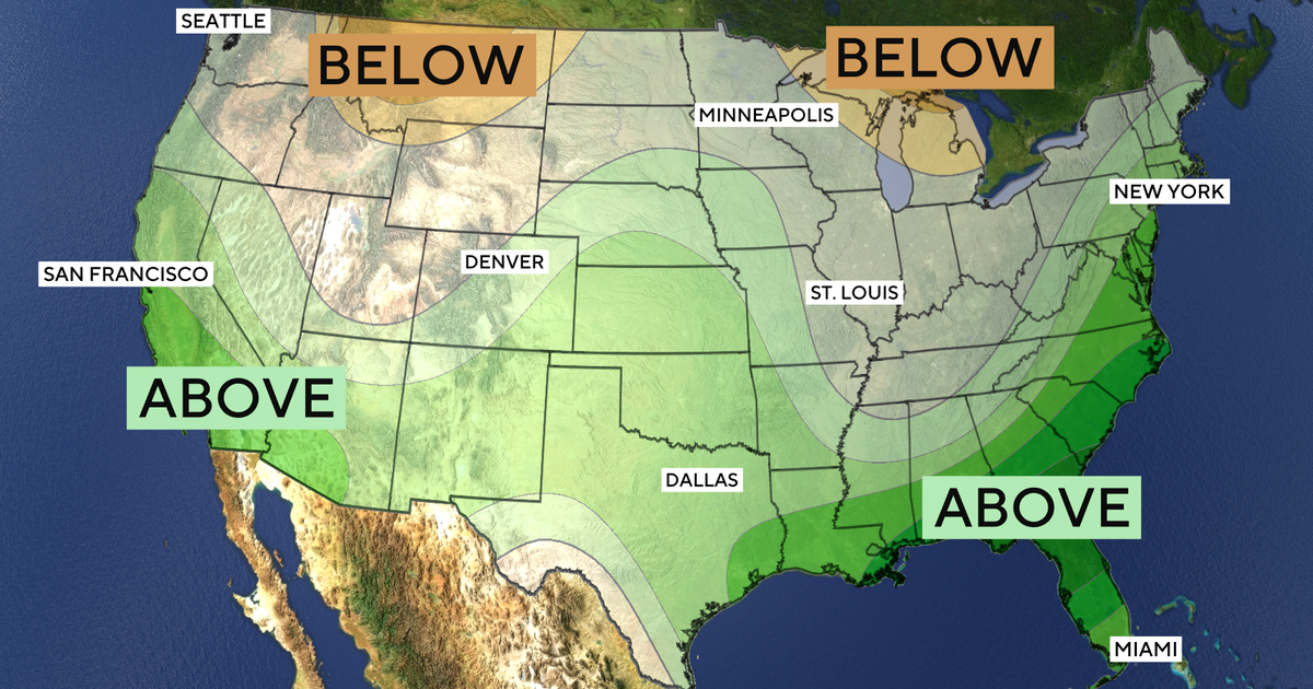
The National Oceanic and Atmospheric Administration’s winter outlook forecasts wetter-than-average conditions across a southern band of the country. This includes the Southwest, Southeast and portions of the East Coast, with El Niño identified as a factor.
The outlook says some parts of the United States may receive much-needed rain and snow after going without enough precipitation. Wetter conditions in much of the South are expected alongside drier-than-average months farther north.
Northern Areas Could Be Drier
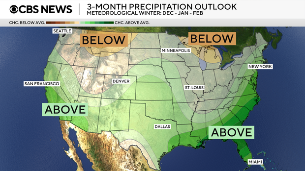
Drier-than-average winter conditions are possible across portions of the Great Lakes, the northern Mountain West, Hawaii and much of Alaska. The outlook attributes the broader contrast between the South and northern tier largely to an exceedingly strong El Niño.
Other areas have equal chances of below-average, near-average or above-average precipitation. Those include parts of the Intermountain West, northern Plains and Ohio Valley.
Temperature Outlook Varies
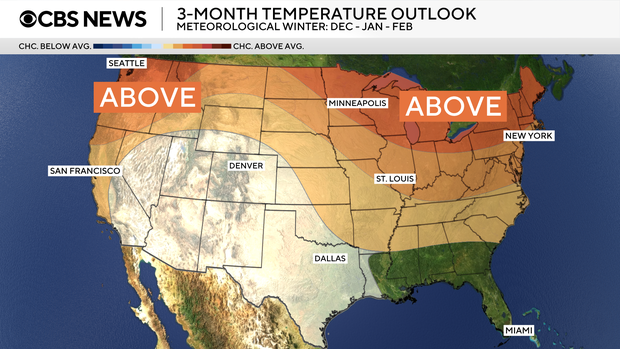
The lower half of the country is mainly expected to have temperatures near normal or potentially just below it. Near-normal temperatures are forecast for portions of the Southeast, including Florida. For much of the Southwest and Hawaii, the outlook gives equal chances of below-average, near-average or above-average temperatures.
Drought Risks Remain
Drought could develop or worsen in some areas, including places already affected by long-standing water shortages. The outlook names Oregon, eastern Washington and parts of the northern Rockies.
Key points
- NOAA expects wetter-than-average conditions across much of the South this winter.
- Parts of the Great Lakes, northern Mountain West, Hawaii and Alaska may be drier than average.
- Some western and northern areas have equal chances of above-, near- or below-average precipitation.
- Drought could develop or worsen in Oregon, eastern Washington and parts of the northern Rockies.